


COOKIE SETTINGS
You can always change your preferences by clicking on the "Cookie Settings" link at the bottom of the page. View our Privacy Policy & Cookie Policy for full details.
Don't miss out on future voucher deals, join our voucher alerts to be the first to benefit from these deals!
Join Voucher List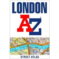
Product Name: London A-Z Street Atlas
Product Category: Books in Media
Product Features :
Navigate your way around London with this detailed and easy-to-use A-Z Street Atlas. First published in 1936, this iconic atlas is a trusted means of finding your way around the capital city. The main mapping extends beyond Central London from Heathrow Airport to Chingford at a scale of 2.88 inches to 1 mile, featuring postcode districts, one-way streets, the Congestion Charging Zone and Low Emission Zone. The large-scale street map of Central London - at a scale of 5.75 inches to 1 mile - cover Regent's Park and Shoreditch, Chelsea and Vauxhall, Hyde Park and Bermondsey. A comprehensive index lists streets, selected flats, walkways and places of interest, place, area and junction names. Additional healthcare (hospitals, walk-in centres and hospices) and transport connections (National Rail, London Tramlink, Docklands Light Railway, London Underground and Overground stations, and River Bus pier) are indexed as well. Also included are:* Overview map of the Congestion Charging Zone* West End Theatre map* London Connections rail services map* London Underground map
ShopMerit works with hundreds of UK retailers to provide you with the best possible prices for Books, deals and retailer vouchers codes. So comparing prices on Books just like London A-Z Street Atlas is easy and also can save your hard earned cash when shopping online.
We’re pretty sure that you’ll find the best price for a London A-Z Street Atlasat ShopMerit.com.
You can always change your preferences by clicking on the "Cookie Settings" link at the bottom of the page. View our Privacy Policy & Cookie Policy for full details.