


COOKIE SETTINGS
You can always change your preferences by clicking on the "Cookie Settings" link at the bottom of the page. View our Privacy Policy & Cookie Policy for full details.
Don't miss out on future voucher deals, join our voucher alerts to be the first to benefit from these deals!
Join Voucher List
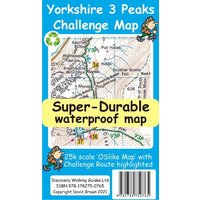
Product Name: Edale Skyline Challenge Map
Product Category: Books in Media
Product Features :
Edale Skyline Challenge is the most scenic of challenge routes thanks to the ridge line nature of its route. At just over 20 miles with a 10 hour challenge time it is suitable for fit leisure walkers as a great day out in good weather; in bad weather it really is a challenge. Free digital app and gps editions included in your purchase To produce our Edale Skyline Challenge Map first we licence Ordnance Survey 50k scale mapping. Then we double it in size to produce a 25k map. Now the OS map features, text and logos are doubled in size making for a map with outstanding clarity which is easy to read under challenge conditions. The Skyline Challenge Route, with its options, are added and specially highlighted so that the challenge route stands out against the OS background map. Then we add any additional detail you might need. The result is a 600mm by 400mm 25k scale map with outstanding clarity and durability. Our special concertina map fold means the map is easy to unfold and to refold to its pocketable 200mm by 120mm folded size.On the reverse of the map sheet we present our detailed Challenge Route description complete with distances and timings for the sections of the route along with the 44 waypoints which define the challenge.We then print the map design on a 100 micron plastic substrate using a special UV curing inks process on the UK's only press capable of using this latest technology. The result is a lightweight map that is both waterproof and tearproof, and fully recyclable, that will survive anything your Challenge can throw at it and afterwards will fold up like new.In addition to our printed Challenge Map we offer you a choice of free digital editions for use with Viewranger and Locus apps and Garmin software and gps units (including Google Earth). We also include the gpx waypoint file for the 44 waypoints in our detailed route description. See the information on the reverse of the map for details of how to download your free digital edition map and gpx waypoint file. After downloading you will have the complete package of Edale Skyline Challenge Map, choice of digital edition Map and gpx file of the waypoints to aid your navigation.
ShopMerit works with hundreds of UK retailers to provide you with the best possible prices for Books, deals and retailer vouchers codes. So comparing prices on Books just like Edale Skyline Challenge Map is easy and also can save your hard earned cash when shopping online.
We’re pretty sure that you’ll find the best price for a Edale Skyline Challenge Mapat ShopMerit.com.
You can always change your preferences by clicking on the "Cookie Settings" link at the bottom of the page. View our Privacy Policy & Cookie Policy for full details.